Synopsis:
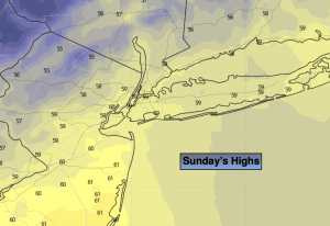
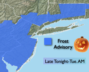
Clear skies and calm winds tonight will result in the likelihood of scattered frost inland. Readings will flirt with the freezing mark in the distant ‘burbs. Yep, there maybe some frost on the pumpkin.
A large dome of high pressure will dominate our weather the entire week and into the weekend. The result will be delightful weather and the start of a significant warming trend. Highs will feel more like early June than later October by late week!
Stay tuned.
Keep it here for a no nonsense, no hype forecast.
Tonight:
Clear. Scattered frost inland. Lows in the upper 40s along the urban corridor, the 30s to around freezing inland. Light North wind.
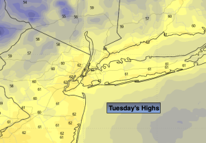
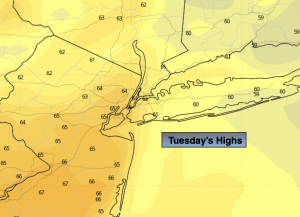
Tuesday:
Sunny. Milder. Highs in the mid 60s. Winds becoming South at 5mph.
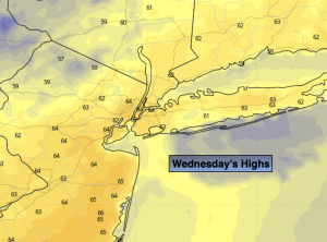
Wednesday:
Sunny. Warmer. Highs in the lower 70s.
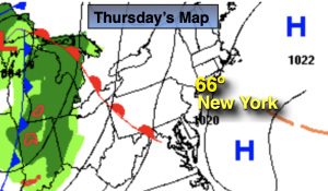
Thursday:
Sunny. Warm. Highs in the mid 70s.
Friday:
Mostly sunny. Warm. Highs in the mid 70s.
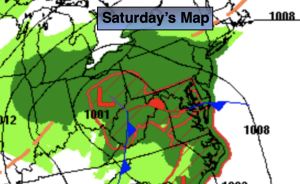
Saturday:
Mostly sunny. Warm. Highs in the mid to upper 70s.