Synopsis:
The region will be dominated by high pressure through today- the better half of the weekend. This will result in mainly sunny skies. Readings will continue to be above seasonable levels. The average high is in the lower to mid 40s.
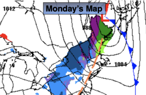
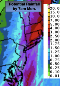
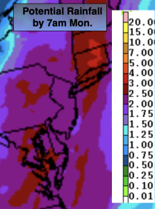
By Sunday, low pressure over Florida will move North and spread clouds our way. There is a chance of patchy drizzle during the morning. Areas of light rain will develop during the afternoon. This storm will intensify as it heads up the coast. The potential is there for heavy rain Sunday night and into a part of Monday. High winds are a possibility as well. Sorry snow lovers, not an ounce of cold air with this one. The storm should be North of us later Monday which should result in a few hours of late day sun.
Behind the storm on Tuesday it’ll be windy and more seasonable under partly sunny skies with a few flurries. Abundant sunshine is anticipated for Wednesday with seasonable readings.
Stay tuned.
Keep it here for a no nonsense, no hype forecast.
Saturday:
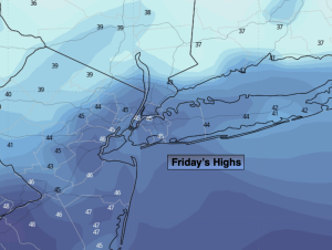
Mostly sunny. Highs in the lower to mid 50s. North to Northeast winds at 5-10mph.
Tonight:
Mostly cloudy. Lows in the mid 40s in the City, the 30s inland. East winds at 5-10mph.
Sunday:
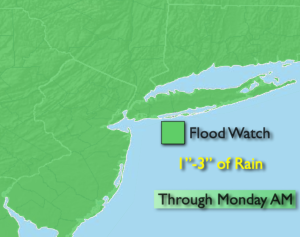
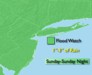
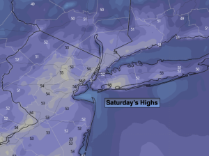
Cloudy. Areas of morning drizzle. On and off light during the afternoon. Highs in the mid 50s.
Monday:
Rain, possibly heavy in the morning. Rain most likely tapering off by afternoon. Some afternoon sun. Mild. Highs in the upper 50s.
Tuesday:
Partly sunny, windy and colder. Chance of flurries. Highs in the lower 40s.
Wednesday:
Sunny. Seasonable. Highs in the lower to mid 40s.