Synopsis:
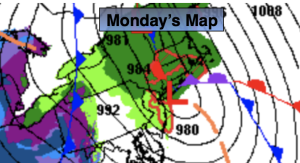
A storm will intensify as it heads up the coast tonight and Monday. Heavy rain will develop during this time and high winds are likely along the coast, especially over Long Island. Sorry snow lovers, not an ounce of cold air with this one.
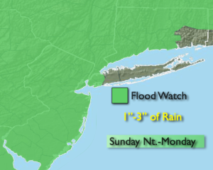
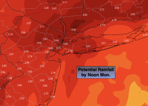
A Flood Watch has been posted for most of the region through Monday. One to nearly four inches of rain is possible. The heaviest axis of rain looks to be from the City and to the North and West (map above). Never drive through flooded roadways, you don’t know how deep the water is- TURN AROUND, DON’T DROWN.
Winds will increase out of the Southeast tonight into Monday morning. A High Wind Warning is up for Brooklyn, Queens, all of Long Island and coastal Connecticut. Wind gusts of 60mph are possible. Heavy rain combined with winds of this strength will cause some trees to topple (mainly weak rooted). Power outages are possible.
The storm will be over the region Monday morning. Highs will be near 60º during the morning. As the low moves North and East the rain and wind will diminish. The sun will return at some point during the late morning or afternoon. Winds will switch to the West and gust between 30-40mph.
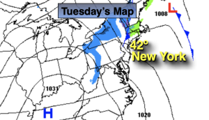
Behind the storm on Tuesday it’ll be windy and more seasonable under partly sunny skies with a few flurries. Abundant sunshine is anticipated mid and to late week. High pressure will dominate and readings won’t be to far off the seasonable average of the lower 40s.
Stay tuned.
Keep it here for a no nonsense, no hype forecast.
Tonight:
Rain, becoming heavy at times. Windy and mild. Lows in the 50s throughout. East to Southeast winds at 15-25mph increasing to 20-35mph with gusts between 50-60mph at the coast and areas to the East of the City.
Monday:
Rain, heavy in the morning. Windy and mild. Rain tapering off later in the morning. Some afternoon sun. Highs in the upper 50s to around 60º. Southeast winds becoming West at 15-30mph with gusts to 40mph.
Tuesday:
Mostly cloudy, windy and colder. Chance of flurries. Highs in the upper 30s to lower 40s.
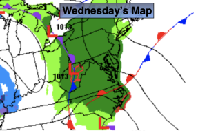
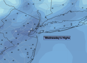
Wednesday:
Sunny. Seasonable. Highs in the lower to mid 40s.
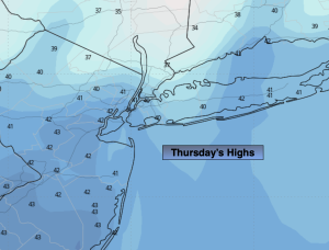
Thursday:
Sunny. Highs in the mid 40s.
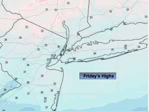
Friday:
Sunny. Highs in the lower to mid 40s.