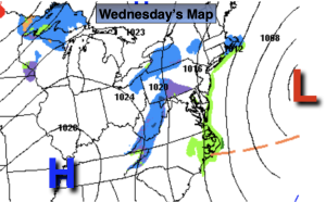
Synopsis:
Low pressure will develop off the Virginia capes today. Precipitation with this storm will remain offshore, although isolated flurries are possible. Winds will become gusty as colder air filters in behind the departing storm.
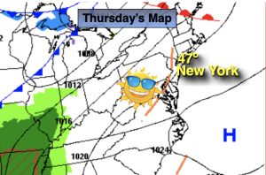
The chill will remain for Thursday. A weakening disturbance moving into the region will result in more clouds and isolated flurries.
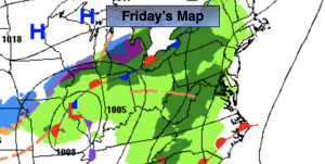
High pressure will build over the Southeast on Friday. This will result in a nicer feel with abundant sunshine.
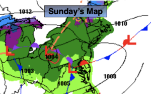
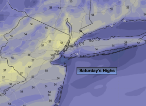
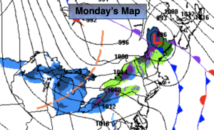
The weekend won’t feel like December as a deep Southerly flow develops around a Western Atlantic high and developing storm over the Southern states. Saturday will be bright and mild with readings ten degrees above average. On Sunday, the intensifying storm will move into the Ohio Valley accompanied by a sharp cold front. We’ll be ahead of this system with balmy readings and rain that will most likely move in during the afternoon. Highs will be near 60º!
Stay tuned.
Keep it here for a no nonsense, no hype forecast.
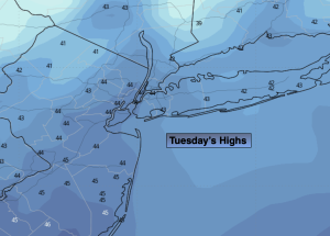
Wednesday:
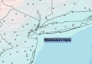
Partly sunny. Breezy. Isolated flurries. Highs in the lower 40s. North to Northwest winds increasing to 10-20mph.
Tonight:
Partly cloudy. Cold. Lows around 30º in the City, the 20s inland. Northwest winds at 8-12mph.
Thursday:
More clouds than sun. Chilly. Isolated flurries. Highs around 40º.
Friday:
Mostly sunny. Not as cold. Highs in the 40s to around 50º.
Saturday:
Mostly sunny. Mild. Highs in the mid 50s.
Sunday:
Mostly sunny. Balmy. Rain developing during the afternoon. Highs around 60º.