Synopsis:
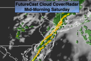
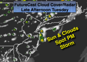
A minor disturbance will work through the region today. There’ll be times of clouds and sun with a spotty shower or storm (FutureCast Radar above). Much of the time it’ll be dry.
High pressure will begin to build off the Southeast coast Wednesday through Friday. Temperatures will rebound by late week. By June’s finale on Friday it’ll be hot once again.
Taking a peek at the holiday weekend- the weather looks typical for July with warm readings and a chance of afternoon scattered storms. It will not be a washout.
Stay tuned.
Today:
Sun and clouds. Spotty showers and storms. Highs in the mid to upper 70s. Southwest to West winds at 10-15mph.
Tonight:
A spotty shower or storm this evening, otherwise mostly clear and cool. Lows in the lower 60s in the City, near 50º inland. Northwest winds at 5mph.
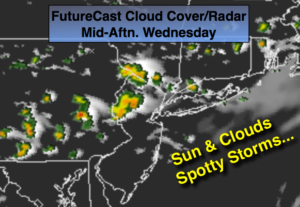
Wednesday:
Sunny with low humidity. A top ten day. Highs around 80º.
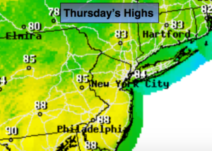
Thursday:
Mostly sunny. Highs in the lower to mid 80s.
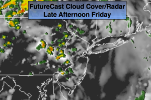
Friday:
Hazy, hot and humid. Spotty PM Storms. Highs around 90º.
Saturday:
Hazy, very warm and humid. Spotty PM storms. Highs in the upper 80s.
Keep it here for a no nonsense, no hype forecast.