Synopsis:
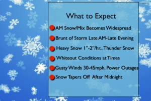
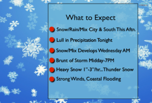
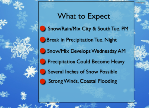
Snow will continue at varying intensities through the evening. The heaviest snow occur along the I-95 corridor, the City and coast. 1″/hr snow rates may occur with snow rapidly accumulating.
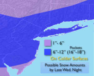
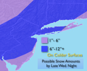
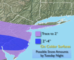
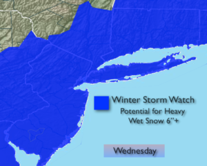
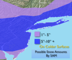
A Winter Storm Warning continues for the entire area into tonight. Most areas will receive between 5″-10″. Over a foot of snow is possible is areas where the heaviest snow bands occur. There will be a sharp cutoff to the heavy snow amounts to the North and Northwest (see map above).
It will be windy with gusts up to 40mph at the coast. Coastal flooding is possible during the times of high tide today.
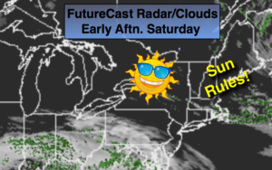
The storm will pull away later tonight and tomorrow. Any snow over Eastern sections early tomorrow morning will end and clouds will break for some sun. It will be windy.
High pressure will nose in from Canada and keep the chill around despite the sunshine into the weekend.
Please check in frequently to this site. Keep it here for a no hype, no nonsense forecast.
Stay tuned.
This Evening:
Periods of snow. Snow could be heavy at times especially over urban areas and to the coast. North to Northeast winds at 15-30mph with gusts to 40-45mph at the coast.
Tonight:
Snow. The snow will taper off from West to East by late evening through late tonight. Lows freezing in the City, the 20s inland. North to Northwest winds at 15-30mph with gusts to 40mph.
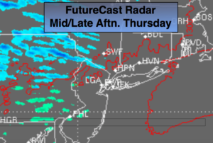
Thursday:
Morning snow East, otherwise, clouds giving way to some sun. Windy. Highs in the lower 40s.
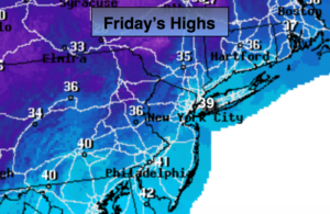
Friday:
Partly sunny, Breezy. Highs in the mid 40s.
Saturday:
Partly sunny. Highs in the mid 40s.
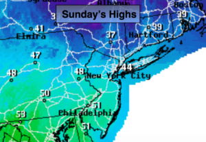
Sunday:
Partly sunny. Highs in the mid 40s.
Keep it here for a no nonsense, no hype forecast.