Synopsis:
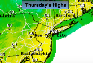
The low responsible for the rain yesterday will pull into Northern New England today and allow for drier air to work. It’ll be mostly sunny and mild.
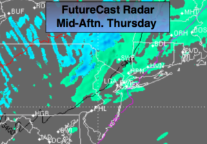
A weak low will rapidly move up the coast on Friday with a period of rain.
The weekend looks fairly decent. A mix of sun and clouds is expected Saturday. As a cold front will approaches in the afternoon, spotty showers are possible. Sunday will be bright and cool with readings several degrees below average. The average high this time of the year is in the mid 60s.
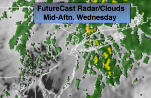
Much warmer weather is in store next week. In fact, it’ll feel like Summer by Wednesday.
Stay tuned.
Today:
Mostly sunny. Mild. Highs in the upper 60s. West winds at 10-15mph.
Tonight:
Clear early becoming mostly cloudy late. Lows in the lower 50s in the City, the 40s inland. Winds Northwest becoming East less than 5mph.
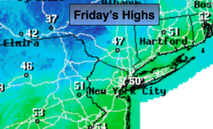
Friday:
Mostly cloudy with a period of rain. Highs in the lower 60s.
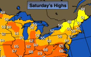
Saturday:
Partly sunny. Spotty afternoon showers. Highs in the mid 60s.
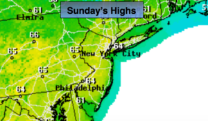
Sunday:
Partly sunny, cooler . Highs in the upper 50s.
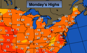
Monday:
Mostly sunny, seasonal. Highs in the mid 60s.
Keep it here for a no nonsense, no hype forecast.