Synopsis:
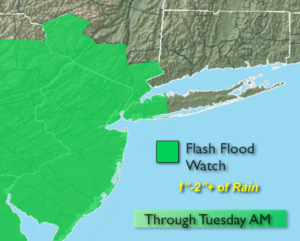
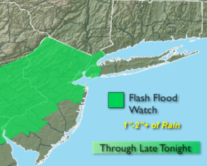
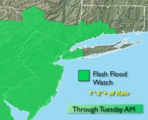
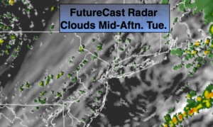
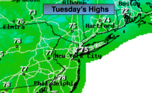
We paid the price for relief from the heat with the torrential rain and thunderstorms. The cool front put an end to the heatwave. Periods of rain will continue this morning as the front slows along the front. A Flash Flood Watch continues through this morning. Any additional rain will continue to cause areas of flooding. If you encounter a flooded roadway-TURN AROUND-DON’T DROWN. The rain will taper off from West to East later this morning and into this afternoon. True relief from the heat and humidity has arrived with highs only reaching the mid 70s. It will feel like a different season!
One last ripple of low pressure may ride up the coast tonight causing a few showers, especially along the coast.
Wednesday through Saturday will be beauties with plenty of sunshine and low humidity to start as high pressure dominates the Eastern one third of the country.
Stay tuned.
Keep it here for a no nonsense, no hype forecast.
Today:
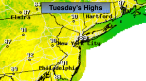
Areas of morning rain, otherwise remaining mostly cloudy. Much cooler and less humid. Highs in the mid 70s. North winds at 5-10mph.
Tonight:
Mostly cloudy, much cooler. Spotty showers, mainly along the coast. Lows in the 60s. The 50s inland.
Wednesday:
Mostly sunny and comfortable. Highs in the lower 80s.
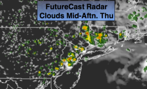
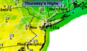
Thursday:
Sunny. Low humidity. Highs in the mid 80s.
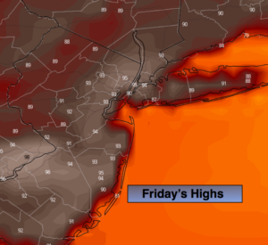
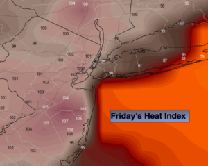
Friday:
Sunny. Highs in the mid to upper 80s.
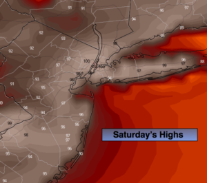
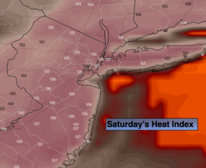
Saturday:
Sunny. Highs in the upper 80s.