
Punxsutawney Phil this morning did not see his shadow. He predicts an early spring for second year in a row.
Synopsis:
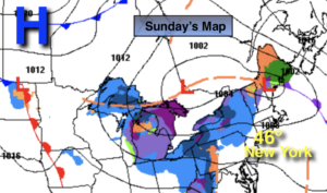
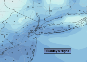
Today will start off bright, but clouds will roll in as a warm front moves toward the region. Scattered rain and snow showers are possible by evening. Readings will be a few degrees above the average high of 39º.
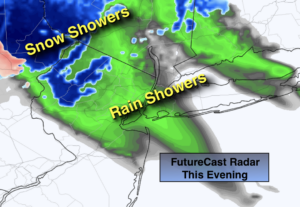
Tonight will be cloudy with scattered rain and or snow showers. North of the City a dusting or coating of snow is possible.
A warmup is on the way for the beginning of the workweek as strong high pressure settles off the Southeast coast. This will result in Spring like readings Monday and Tuesday. Spotty showers are possible on Tuesday and Wednesday as a cold front approaches. Wednesday will be cooler as the wind turns to the North.
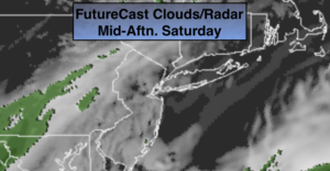
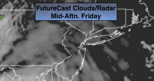
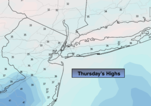
It will get quite active late week as a front stalls along the East coast and waves of low pressure ride up the coast. It maybe cold enough as high pressure noses in from Eastern Canada on Thursday for a potential mix of snow, freezing rain, sleet and or rain. Most areas look to be rain on Friday as the second wave of low pressure moves North and the cold high moves into the Northern Atlantic. Please check back with JMW for the latest very latest.
Stay Tuned.
Keep it here for a no nonsense, no hype forecast.
Today:
Early sun will give way to clouds. Scattered rain and or snow showers are possible by evening. Highs in the lower to mid 40s. Northwest to West winds at 5-10mph.
Tonight:
Cloudy with scattered rain or snow showers. Lows in the upper 30s in the City, closer to 30º inland. West to Northwest winds at 5-10mph.
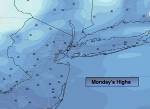
Monday:
Partly sunny and much milder. Highs in the mid 50s.
Tuesday:
Mostly cloudy. Mild. Spotty showers are possible. Highs in the mid 50s.
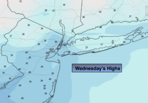
Wednesday:
Mostly cloudy. Scattered showers. Cooler. Highs in the lower 40s.
Thursday:
Colder. The potential for snow, freezing rain, sleet and or rain. Highs in the 30s.