Synopsis:
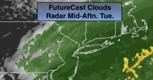
On and off rain will continue through early to mid afternoon as low pressure moves along a front to our South. It will be mild. Drier air will work in from the North and the rain will end later today.
High pressure will dominate our region on Wednesday with abundant sunshine and tolerable temperatures.
A low will develop over South Thursday and move North and East. The track will be to our West. This will result in another round rain and mild temperatures.
Behind the low cold air will arrive Friday under mostly sunny skies. A semi-Arctic push of air will move in from the North. Friday night will be the coldest it’s been in some time. The weekend will be sunny and cold with readings below the average high of 40º.
Stay Tuned.
Keep it here for a no nonsense, no hype forecast.
Today:
On and off rain through early to mid afternoon. Mild. Highs around 50º. Northeast to Northwest winds at 5-10mph.
Tonight:
Becoming Partly cloudy. Lows around 35º in the City, the 20 inland. Northwest winds at 10-15mph.
Wednesday:
Mostly sunny. Highs in the mid 40s.
Thursday:
Cloudy with rain. Highs around 50º.
Friday:
Mostly sunny, colder. Highs in the lower 30s.
Saturday:
Sunny. Highs in the 20s to around 30º.