Synopsis:.
Today will start off with clouds as leftover moisture remains from a departing trough of low pressure. Skies should brighten during the afternoon. Temperatures will be below the average high of 53º.
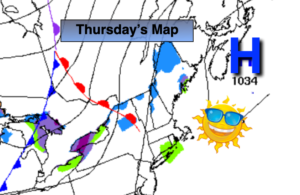
A brighter day is expected for Thursday as high pressure moves in from the West. Readings should be near average for the day.
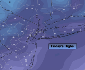
A cold front will approach Friday. Ahead of it it’ll be mild under a mix of sun and clouds. An isolated shower is possible later in the day.
Saturday will start off with sun but clouds will roll in for the second half of the day. Low pressure will move to the Northeast out of the Central Appalachian states. Showers are possible later in the day Saturday.
The models now have a vigorous upper level low developing with the surface low pressure. If conditions are just right enough cold air may be brought down from the upper atmosphere to change the rain to wet snow Saturday night and into Sunday morning as the surface storm moves just South of the area. The greatest chance of this happening is North and West of the City. This scenario is 4 days away and a lot can change between now and then. Just keep in mind the potential is there for wet snow for a time inland Saturday Night.
Any mixed precipitation or rain will taper off toward midday Sunday. The sun should return for a time during the afternoon.
Stay Tuned.
Keep it here for a no hype, no nonsense forecast.
Today:
Clouds to some afternoon sun. Highs in the mid 40s. Northwest winds at 10-15mph.
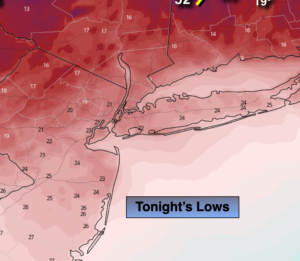
Tonight:
Partly cloudy. Lows in the mid 30s in the City, the upper 20s to around freezing North and West. Northwest winds at 10-15mph.
Thursday:
Sunny. Highs in the lower 50s.
Friday:
Sun and clouds, milder. Spotty PM showers. Highs in the upper 50s.
Saturday:
Sun and clouds. Much cooler with a chance of afternoon showers. Highs in the mid 40s.
Sunday:
Morning rain or wet snow (N/W). Skies should brighten during the afternoon. Highs in the mid 40s.