Synopsis:.
The coldest airmass of the season so far will be will be upon us today as Canadian high pressure works in. A record low happened yesterday at midnight of 25º. Also, the forecast low is for 22º at Central Park this morning, the record is 24º set in 1986. This record has been broken as well.
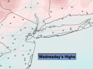
Despite the sunshine today, readings will only be near freezing. The record low maximum temperature for today is 33º set in 1911. We have a chance of tying that record as well (lots of statistics, I know)!
The weather looks to cooperate through the end of the week as high pressure dominates the Mid-Atlantic. Readings will recover slowly to near 50º by Friday. At least the sun will be shining.
The weekend is looking decent, but chilly. Another shot of cold air will move in on Saturday as high pressure over Eastern Canada influences our weather. Sunday won’t be as harsh. Sunshine will continue to dominate our skies. A storm off the Southeast coast should stay far enough to the South and East to not affect our weather this weekend.
Stay Tuned.
Keep it here for a no hype, no nonsense forecast.
Today:
Mostly sunny, breezy and cold. Highs only in the lower to mid 30s. Northwest winds at 10-20mph. Winds will diminish this afternoon.
Tonight:
Clear to partly cloudy. Lows in the upper 20s in the City. A wide range of temperatures will occur inland. Lows will be from 7º above to the 20s depending on your location. Light North to East winds at 5mph or less.
Thursday:
Mostly sunny. Chilly. Highs in the mid 40s.
Friday:
Mostly sunny. Highs around 50º.
Saturday:
Mostly sunny. Colder. Highs in the upper 30s.
Sunday:
Mostly sunny. Highs in the mid 40s.