Synopsis:.
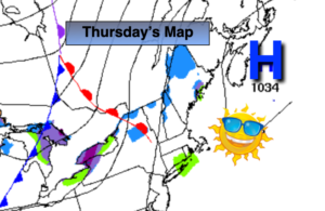
High pressure that gave the region our Winter-like temperatures will move off the Northeast coast today. The winds around the departing high will veer to the Southwest. This will result in conditions being not as harsh today under a mix of sun and clouds.
It will be a better feel Friday with Readings recovering to near 50º ahead of the next cold front.
The weekend is looking decent, but chilly. Another shot of cold air will move in on Saturday as high pressure over Eastern Canada influences our weather. Sunday won’t be as harsh. Sunshine will continue to dominate our skies. A storm off the Southeast coast should stay far enough to the South and East to not affect our weather this weekend.
Stay Tuned.
Keep it here for a no hype, no nonsense forecast.
Today:
Sun and clouds. Chilly. Highs in the mid 40s. South to Southwest winds at 5-10mph.
Tonight:
Partly cloudy. Not as cold as recent nights. Lows around 40º in the City, the 20s and 30s inland. Southwest to West winds at 5-10mph.
Friday:
Mostly sunny. Highs around 50º.
Saturday:
Mostly sunny. Colder. Highs in the upper 30s.
Sunday:
Mostly sunny. Highs in the lower to mid 40s.
Monday:
Mostly sunny. Highs in the upper 40s.