Synopsis:
A cool front will move toward the region today with on and off showers- meaning there will be dry times. It’ll be mild ahead of the front with readings flirting with 50º. Scattered showers will continue into the evening, otherwise skies will clear late as the front pushes East.
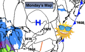
The sun will dominate for the mid to late week period as extensive high pressure dominates the Eastern one half of the nation. A cold push will arrive Thursday and Friday with readings below average.
The snow drought continues as the weather pattern is not favorable for cold and nearby storm formation.
Stay Tuned.
Keep it here for a no nonsense, no hype forecast.
Today:
On and off showers. Mild. Highs in the 40s to around 50º. East to Southeast winds at 5-10mph.
Tonight:
Scattered showers early tonight. Clearing late. Lows in the upper 30s in the City, near freezing inland. Southwest to Northwest winds at 8-12mph.
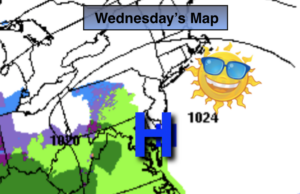
Wednesday:
Mostly sunny. Highs in the mid 40s.
Thursday:
Mostly sunny and colder. Highs in the lower 30s.
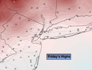
Friday:
Sunny. Chilly. Highs in the mid 30s.
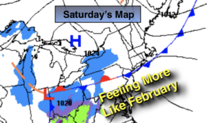
Saturday:
Sunny. Milder. Highs in the upper 40s.