Synopsis:
High pressure over the Western Atlantic will cause the wind to blow from the South. Moisture will ride up and around the offshore high pressure. A weakening surface and upper level low that has been over the Southeast will also drift slowly North over the next couple of days. The result will be more clouds and higher humidity and temperatures through Father’s Day weekend. There will be times of sun. Each afternoon will feature the chance of scattered showers. It will not be a washout and much of the time will be dry. I am not canceling my outdoor plans this weekend!
Summer Arrives at 5:44PM EDT Saturday.
Stay Tuned.
Keep it here for a no nonsense, no hype forecast.
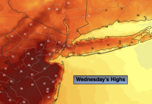
Today:
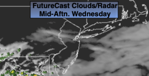
Morning clouds and fog. A few breaks of sun during the afternoon. A spot shower can’t be ruled out. Highs in the mid to upper 70s. East to Southeast winds at 5-10mph.
Tonight:
Cloudy. Patchy Fog. Muggy. Lows in the 60s throughout. Southeast winds less than 5mph.
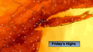
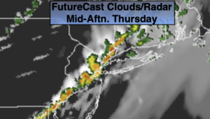
Friday:
Sun and clouds. Scattered PM showers. Highs in the lower 80s.
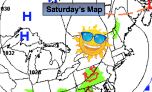
Saturday:
Sun and clouds. Warm and humid. Scattered PM Showers. Highs in the mid 80s.
Father’s Day:
Sun and clouds. Warm and humid. Scattered PM Showers. Highs in the mid 80s.
Monday:
Sun and clouds. Warm and humid. Scattered PM Showers. Highs in the mid to upper 80s.