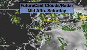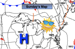
Synopsis:
Today-May’s Finale will be sunny and cooler as high pressure influences the region from the Great Lakes. Readings will be several degrees lower than the average high of 75º.
Tonight will be clear, chilly and tranquil. Great sleeping weather, but you may need that blanket!
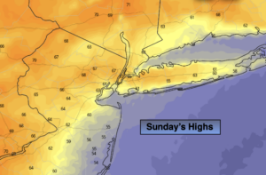
June’s Debut tomorrow will feature the same conditions as Sunday’s delight.
High pressure will settle over the Southeast by midweek. This setup will result in moderating temperatures. The next chance of showers will be Wednesday with an impulse heading our way from the West. Readings will get into the 80s for the mid to late week period.
Stay Tuned.
Keep it here for a no nonsense, no hype forecast.
Today:
Sunny and pleasant. Highs in the 60s to around 70º in the City. Northwest winds at 10-15mph with gusts to 20mph.
Tonight:
Clear. Much cooler. Lows in the lower 50s along the urban corridor, the 40s inland. Northwest winds 5-10mph.
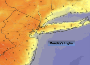
Monday:
Mostly sunny. Highs around 70º.
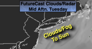
Tuesday:
Partly sunny. Highs in the lower 70s.
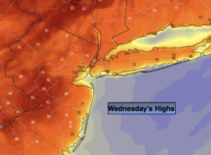
Wednesday:
Partly sunny. Warmer. Chance of afternoon showers. Highs in the lower to mid 80s.
Thursday:
Partly sunny. Highs in the lower 80s.