Synopsis:
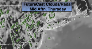
Today will be mainly cloudy with areas of morning drizzle and fog. The fog will burn off during the morning. It will be much cooler with the cloud cover, but it will be humid. Scattered showers are possible this afternoon. This is due to a moist Southerly flow.
The clouds will stick around tonight with fog redeveloping. On and off drizzle or scattered showers are possible.
Friday’s weather map will feature a cool front approaching. Ahead of the front it will be warm and humid. Clouds and some hazy sun is expected with spotty showers and possible storms. Much of the time will be dry.
The front will be slow to exit resulting in a morning clouds and possible showers on Saturday. The system will push East and the sun should return by afternoon. Sunday-May’s Finale will be sunny and cooler as high pressure influences the region from Canada. June arrives on Monday with cooler than average temperatures under a mix of sun and clouds.
Stay Tuned.
Keep it here for a no nonsense, no hype forecast.
Today:
Mostly cloudy with areas of drizzle and morning fog. Scattered afternoon showers. Humid. Highs in the lower 70s.
Tonight:
Cloudy with patchy fog and areas of drizzle and scattered showers. Mild. Lows in the lower to mid 60s. South winds less than 5mph.
Friday:
Areas of morning fog and drizzle, otherwise hazy, warm and humid. Late afternoon and evening scattered showers and possible storms. Highs around 80º.
Saturday:
Morning clouds and showers. Some afternoon sun. Highs in the upper 70s.
Sunday:
Sunny and cooler. Highs in the lower 70s.
Monday:
Partly sunny. Cool. Highs in the upper 60s.