Synopsis:
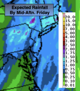
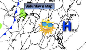
The weekend will be a 50/50 split. High pressure will dominate on Saturday with mainly sunny skies (high clouds will filter the sun later today). It will be chilly temperatures. On Sunday, a return flow from the South will develop as the area of high pressure moves into the Western Atlantic. Clouds will dominate and a few late day showers are possible. Temperatures will be seasonal.
Showers are likely Sunday night as a cold front approaches.
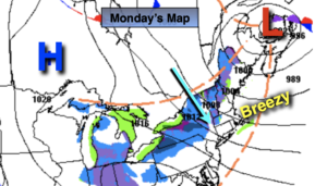
The front will move through Monday morning. Any early morning showers will give way to mainly sunny skies. High temperatures will occur in the morning. During the afternoon a strong Northwest wind will develop and readings will being to tumble.
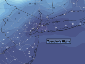
Tuesday will be the coldest day of the season so far with a gusty wind from Canada. Temperatures will be ten degrees below average with windchills near freezing. At least it’ll be sunny.
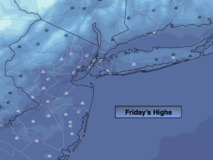
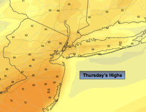
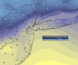
Looking ahead to Wednesday and Thanksgiving in our region; it looks like the weather will cooperate for travel with readings slowly moderating.
You know where to find a no hype, no nonsense forecast.
Stay tuned.
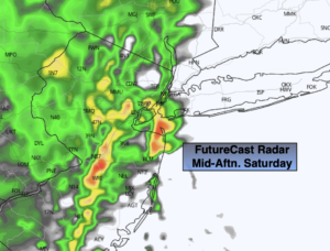
Saturday:
Sunny. High afternoon clouds. Chilly. Highs in the upper 40s. Northeast to Southeast winds at 5mph.
Tonight:
Mostly cloudy. Lows in the lower 40s in the City, the 30s inland. Southwest winds diminishing to 5mph.
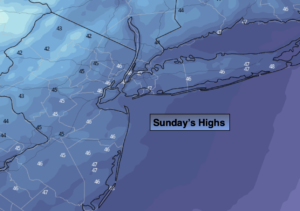
Sunday:
Mostly cloudy with late day scattered showers possible. More seasonal. Highs in the mid 50s.
Monday:
Early morning showers giving way to mainly sunny skies. Increasing winds later in the day. Highs will be in the 50s during the morning, then fall into the 40s by mid to late afternoon.
Tuesday:
Mostly sunny, windy and cold. Highs in the upper 30s to lower 40s.
Wednesday:
Sunny and quite cool. Highs in the mid to upper 40s.