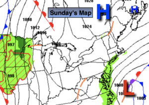
Synopsis:
A moist Southerly flow will continue this weekend as a Western Atlantic high results in a Southerly wind. It will be humid.
Morning patchy fog and clouds will give way to some sun as the day goes on. Today will be the drier of the two weekend days. A bulb of warm, humid air will move into the region. Temperatures will be well above average by several degrees.
It’ll be muggy tonight with a few showers.
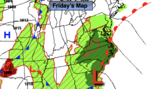
Monday will be warm ahead of a cool front. A mix of clouds and sun is expected. Showers and thunderstorms are expected during the late afternoon and evening. Some of the storms may become severe. Keep an eye to the sky for threatening weather.
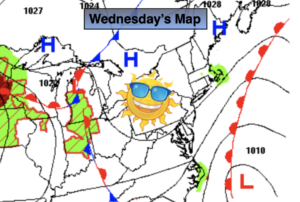
Slightly cooler readings are expected for Tuesday through Thursday under a bright sky as high pressure moves in from the Northwest.
Stay tuned.
Keep it here for a no hype, no nonsense forecast.
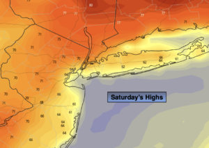
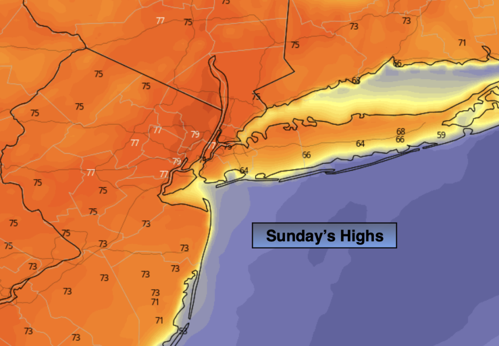
Sunday:
Morning clouds and patchy fog giving way to some sun. Warmer. Highs in the upper 70s. South winds at 5-10mph.
Tonight:
Scattered showers. Areas of fog developing. Lows in the 60s throughout. Light South winds.
Monday:
Sun and clouds. Warm. Afternoon showers and thunderstorms. Some of the storms maybe strong to severe. Highs in the upper 70s.
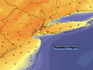
Tuesday:
Sunny. Highs in the lower to mid 70s.
Wednesday:
Sunny. Highs in the lower 70s.
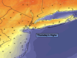
Thursday:
Partly sunny. Highs in the upper 60s to around 70º.
Catch me on the Fox Business Network from 6am-9am this weekend and on the Fox Weather Stream until Noon. Find us on Tubi, Roku TV and YouTube TV and as always the Fox Weather App. It’s Free!