Synopsis:
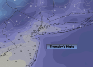
Scattered showers will greet us this morning. Asa low heads into the central Appalachians during the day steadier rain will develop. It’ll be unseasonably cool with reading almost fifteen degrees below the average high of 69º. Temperatures will actually drop into the lower 50s later in the day.
Rain maybe heavy at times Friday night into Saturday morning as the storm moves to coastal Maryland.
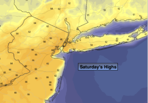
The low will move slowly off the Eastern seaboard Saturday afternoon. Rain will lighten up and possibly taper off to the North of the City. Total rainfall of one to two inches is quite likely. It will be raw, breezy and very chilly. A good day for a book or movie.
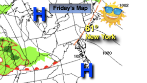
By Mother’s Day, the storm should move far enough offshore for any morning clouds and possible showers to give way to some sunshine. I’m keeping my fingers crossed. It’ll be chilly and breezy as high pressure funnels in from Eastern Canada.
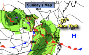
The low will remain in the Western Atlantic and may retrograde toward the coast on Monday. There is a low potential that a shield of rain may work in from the Atlantic. One thing is for sure the wind will be busy and temperatures will remain below normal.
Tuesday the atmosphere will dry out. A mix of sun and clouds is expected with more pleasant temperatures.
Stay tuned.
Keep it here for a no hype, no nonsense forecast.
Friday:
Scattered morning showers becoming a steadier rain during the afternoon. Much cooler. Highs in the mid 50s. East winds at 8-12mph.
Tonight:
Rain, heavy at times. Becoming windy. Lows in the 40s throughout. Northeast winds increasing to 15-25mph with gusts to 35mph at the coast.
Saturday:
Rain. Breezy and unseasonably cool. Highs in the lower 50s.
Mother’s Day:
Possible morning showers, otherwise becoming partly sunny. Breezy and cool. Highs in the mid to upper 50s.
Monday:
Clouds and sun. Breezy. Low potential for some rain. Highs in the lower 60s.
Tuesday:
Partly sunny. Highs in the mid 60s.
Catch me on the Fox Weather Stream from 10am-1pm on Friday. Find us on Tubi, Roku TV and YouTube TV and as always the Fox Weather App. It’s Free!