Synopsis:
We’ll continue with our late Summer theme as we close out August and welcome September this week. High pressure will be in control. The only threat of a storm is Tuesday night with a weak front passing through.
It’ll be humid through Tuesday. Drier air will work in midweek and stick around through Friday. Temperatures will become more seasonable by late week, meaning the lower 80s. More sun than clouds are expected.
Keep it here for a no hype, no nonsense forecast.
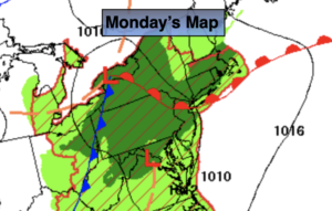
Monday:
Mostly sunny. Humid. Highs in the mid to upper 80s. Southeast winds at 5-10mph.
Tonight:
Mostly clear and warm. Lows in the mid 70s in urban areas, the 60s North and West. South winds at 5mph.
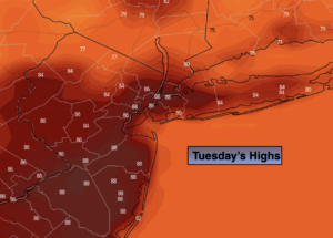
Tuesday:
Mostly sunny, hot and humid. Scattered shower and storms possible during the evening. Highs in the upper 80s to lower 90s.
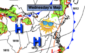
Wednesday:
Mostly sunny. Not as humid. Highs in the mid to upper 80s.
Thursday:
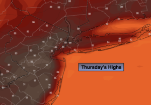
Mostly sunny. Highs in the mid 80s.
Friday:
Mostly sunny. Highs in the lower 80s.
Catch me Saturday on the Fox Business Network from 6am-9am on the Weather Stream until 10am. Find us on Tubi, Roku TV and YouTube TV and as always the Fox Weather App. It’s Free!