Synopsis:
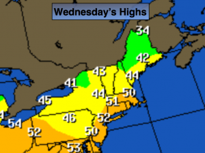
A January thaw is upon us as our flow will continue out of the Southwest through the end of the week. Say goodbye to the snow on the ground. Temperatures today will be well above average. A more significant warm front will move into the area tonight with a period of rain. Thursday will be April-like with readings some twenty degrees above average.
Looking down the pike, our next shot of wintry weather comes late Saturday afternoon and Saturday night. A strong, cold high will be to our North as a stationary front throws moisture to the North. The potential is there for Light snow. The question is-how much moisture will work into the immediate tri-state area? As of this writing the computer models are not robust at all with precip amounts-meaning not a significant snowfall. Possibly just some flurries. Stay tuned.
Today:
Partly sunny and mild. Highs in the lower 50s. Southwest winds at 10-15mph.
Tonight:
Rain developing by late evening. Mild. Steady to slowly rising temperatures. Lows will be in the 40s to lower 50s. Southeast to Southwest winds at 10-15mph.
Thursday:
More clouds than sun. A sprinkle is possible. Spring-like. Highs in the upper 50s.
Friday:
Partly sunny. The thaw continues. Highs in the upper 40s. The average high for this time of the year is 38º.
Saturday:
Sun will give way to increasing clouds. Colder. Highs in the mid 30s. Chance of light snow or flurries later in the afternoon and at night.
Sunday:
Partly sunny and seasonal with readings in the upper 30s.
Stay Tuned.
Keep it here for a no nonsense, no hype forecast.