Synopsis:
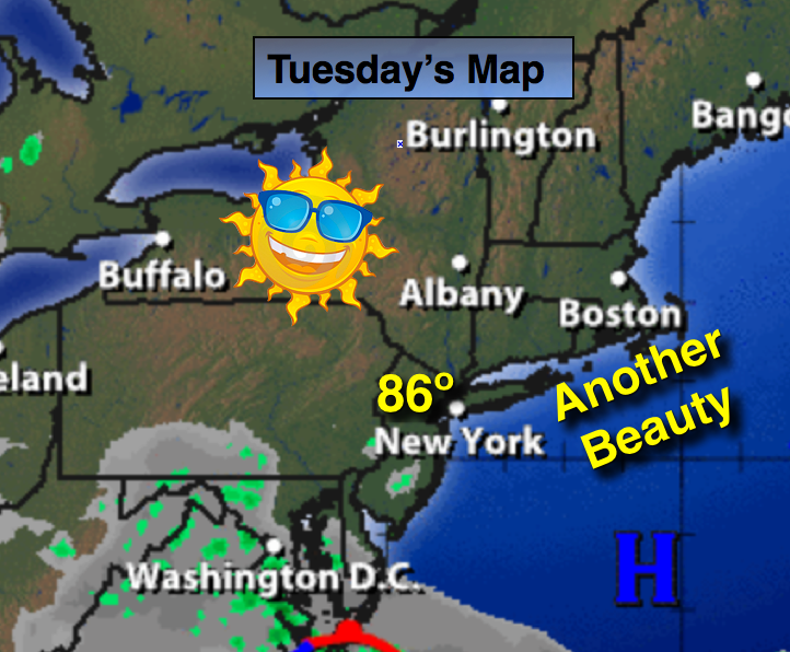
High pressure off the coast will provide the area with one more beauty for August -the humidity will be low and temperatures will be tolerable. By tomorrow the high will move off the coast. This will set up a warmer and more humid flow. The push of humid air along with a weak disturbance in the upper atmosphere will cause scattered showers and thunderstorms to occur on Wednesday. The threat will be with us all day. As the region gets deep into a Southwest flow Thursday through Saturday the threat of afternoon storms will be in the spotty category. Much the time will be dry. Besides the PM storm threat, the 3 H’s will be the top story. Temperatures will top 90º late week into the weekend with high levels of humidity. The heat index will approach 100º in many areas. Yes, August’s mean side will be with us for some time.
Today:
Sunny and warm. Highs in the mid to upper 80s. South wind at 10-15mph.
Tonight:
Clear early become mostly cloudy toward sunrise with increasing humidity. Lows in the lower 70s in the City, the upper 60s inland. South wind at 5mph.
Wednesday:
Mostly cloudy with scattered thunderstorms just about any time. Warm and humid with readings in the mid 80s.
Thursday:
Hazy, hot and humid. A spotty afternoon storm is possible. Highs around 90º
Friday:
Hazy, hot and humid with spotty PM storms. Highs in the lower 90s. Heat index around 100º.
Saturday:
Hazy, hot and humid with spotty PM Storms. Highs in the lower 90s. Heat index around 100º.
Stay Tuned.
Keep it here for a no nonsense, no hype forecast.