Synopsis:
High pressure will basically sit on or off the East coast through Saturday.
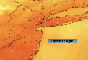
As the high moves off the coast milder air will work in for Thursday. It’ll be bright with readings above the average high of the upper 60s.
Friday and Saturday will feature near average temperatures and plenty of sunshine.
Any sun will give way to clouds on Sunday as moisture moves up from the South. Periods of rain are likely as the remnants of tropical system Isaias moves up the spine of the Appalachians. The on and off rain should continue into the night. At this time, it doesn’t look like a major event for our area concerning rainfall.
The system should move out by sunrise Monday. Any clouds will give way to sun.
Stay tuned.
Keep it here for a no nonsense, no hype forecast…
Tonight:
Clear and cool. Lows in the upper 50s in the City, the 40s inland. Light Southwest winds.
Thursday:
Sunny. Mild. Highs in the mid 70s. West to Northwest winds at 10-15mph.
Friday:
Sunny. Pleasant. Highs around 70º.
Saturday:
Sunny. Pleasant. Highs around 70º.
Sunday:
Mostly cloudy with periods of rain during the afternoon. Highs in the upper 60s.
Monday:
Clouds to sun. Highs around 70º.