Synopsis:
A few clouds will roll in for today as winds veer to the South. An isolated storm is possible during the afternoon.
Tuesday will feature a warm front moving in. Mainly cloudy skies are expected. Scattered showers and storms are possible just about anytime. You’ll notice an increase in the humidity. Some of the storms may become strong to severe. Torrential rain is possible. We’ll need to keep an eye out for flooding.
A showers will dot the region on Wednesday and Thursday as weak low pressure will be slow to move offshore.
Friday will be the best day out of the bunch as the system finally moves far enough offshore to allow for mainly sunny skies. Temperatures will still be tolerable.
Stay tuned.
Keep it here for a no nonsense, no hype forecast….
Monday:
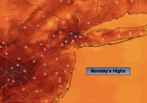
Partly sunny. An isolated afternoon storm is possible. Highs in the lower 80s. Southeast winds at 5-10mph.
Tonight:
An evening isolated storm, otherwise, partly cloudy. Lows in the lower 70s in the City, the 60s inland. Light South Winds.
Tuesday:
Mostly cloudy. Humid. Scattered showers and storms. Highs in the upper 70s.
Wednesday:
Mostly cloudy. A few showers are possible. Highs in the upper 70s.
Thursday:
Partly sunny. A few showers possible. Highs in the upper 70s.
Friday:
Partly sunny. Highs around 80º.