Synopsis:
Today through Wednesday will be unsettled. The best chance of rain will be today with the strongest of the a series of disturbances moving through. Readings will be near the seasonable averages of the lower 60s.
The threat of scattered showers, areas of drizzle and fog are in the forecast through midweek as the flow will be coming off the ocean and weak disturbances move in from time to time. It will not be a washout. Temperatures will rise to above average levels Tuesday and Wednesday as milder air works in from the Southwest.
We’ll finally get a break from the dismal weather by Thursday as high pressure moves in. Mostly sunny skies are expected with mild readings. Friday will be a winner as well with cooler readings.
Stay tuned.
Keep it here for a no hype, no nonsense forecast.
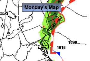
Monday:
On and off rain. Highs in the lower 60s. Northeast winds at 5-10mph.
Tonight:
Scattered showers, areas of drizzle and fog. Lows in the 50s throughout. Northeast winds 5mph.
Tuesday:
Spotty Drizzle. Areas of fog. Milder. Highs in the upper 60s.
Wednesday:
Clouds, some sun. Scattered showers possible. Highs in the upper 60s.
Thursday:
Mostly sunny. Mild. .Highs in the upper 60s.
Friday:
Sunny. More seasonable. Highs in the lower 60s.