Synopsis:
A mix of sun and clouds is expected as a cold front approaches today. Readings will be several degrees above the average high of 38º. A few flurries are possible later in the day with the passage of the front.
We’ll be in January’s grip tonight with an Arctic airmass spilling in. Lows will be well below freezing.
Strong high pressure over Canada will influence our weather this weekend. Sunny skies are expected with below average temperatures. Saturday the wind will add a bite. Sunday will be more tranquil.
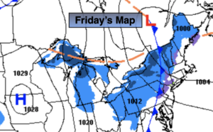
Low pressure will be over the Central Appalachians on Monday. Any sun will give way to increasing and thickening clouds. The potential has increased some for a period of snow Monday evening into a part of Tuesday as the low spreads a swath of snow our way. An accumulation is possible, but it’s way too early to discuss any amounts. This does not look like a major snowfall at this time.
Stay Tuned.
Keep it here for a no nonsense, no hype forecast.
Today:
Partly sunny. Breezy. Chance of late day flurries. Highs in the lower 40s. West to Northwest winds at 10-20mph.
Tonight:
Clear, breezy and very cold. Lows in the mid 20s in the City, the teens inland. Northwest winds at 10-20mph.
Saturday:
Mostly sunny. Windy. Highs around freezing. Wind chills in the 20s.
Sunday:
Sunny. Highs in the lower to mid 30s.
Monday:
Increasing clouds. Potential of late day or evening snow. Highs in the mid 30s.
Tuesday:
Chance of some snow, especially during the morning. Highs in the mid 30s.