Synopsis:
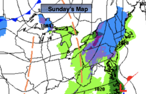
There will be areas of light snow today. Showers will fall where it’s just warm enough to the South and over parts of the immediate coast. There could be a coating of snow where snow falls the steadiest. This is due to a weak low both along the Mid-Atlantic coast and at the upper levels of the atmosphere. It will not be as cold today.
Any light precipitation will end this evening. Skies will remain mostly cloudy.
Temperatures will moderate Monday and reach just above averages under mostly cloudy skies. The average high is 39º. Winter arrives at 5:02AM EST Monday.
Tranquil conditions will be with us through midweek with readings near seasonal levels. The average high temperature is around 40º.
Christmas Eve will feature a developing deep Southerly flow ahead of a cold front and developing storm. Readings will pop into the 50s and showers are likely later in day. It should dry out for Christmas Day with falling temperatures. It does not look like a White Christmas unless those of you that have deep snowpack will be able to keep it until Christmas morning.
Stay Tuned.
Keep it here for a no nonsense, no hype forecast.
Today:
Areas of light snow and showers to the South. A coating of snow is possible in spots. Highs in the 30s to around 40º. Southwest winds at 5mph.
Tonight:
Any scattered light precipitation will end this evening . Lows around 35º in City, the 20s inland. Light Southwest wind.
Monday:
Mostly cloudy. Highs in the lower 40s.
Tuesday:
Party sunny. Highs in the lower 40s.
Wednesday:
Sunny. Highs in the lower 40s.
Christmas Eve:
Mostly cloudy with scattered showers by evening. Balmy. Highs in the mid 50s.