Synopsis:
High pressure will settle over the Mid-Atlantic today resulting in a bright, but cool day. Sunday may start off sunny, but a frontal system moving toward the region during the afternoon will increase the clouds and bring in the threat of showers. The winds will pick up during the afternoon and become gusty.
Monday through Wednesday will be dry but getting progressively colder as a dominant Northwesterly flow prevails from Canada. The wind will add a bite to the chill. Readings by midweek will be at least ten degrees below the average high of 54º.
Stay Tuned.
Keep it here for a no nonsense, no hype forecast.
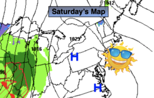
Today:
Sunny, breezy and seasonal. Highs in the lower to mid 50s. Northwest winds at 10-20mph.
Tonight:
Clear and chilly. Lows in the lower 40s in the City, the 20 & 30s inland. Light winds.
Sunday:
Morning sun to afternoon showers. Becoming windy. Highs in the upper 50s.
Monday:
Mostly sunny and breezy. Highs in the lower 50s.
Tuesday:
Mostly sunny. Chilly. Highs in the upper 40s.
Wednesday:
Mostly sunny. Cold. Highs in the lower 40s.