Synopsis:
Today and tomorrow will be gems with abundant sunshine and mild to warm readings as high pressure moves off the coast.
A cold front will approach on Friday. Any morning sun will give way to clouds and scattered afternoon showers. Steadier rain is likely later in the afternoon. Low pressure will be developing along the front Friday night. This may enhance the rainfall.
The front should move off the coast early Saturday morning with clouds giving way to sunshine. There will be a nip in the air.
Sunday looks bright and seasonal as high pressure moves in.
Stay Tuned.
Keep it here for a no nonsense, no hype forecast.
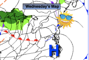
Today:
Sunny and mild. Highs around 70º. West winds at 5-10mph.
Tonight:
Mostly clear. Lows in the mid to upper 50s in the City, the 40s inland. Northwest winds at 5-10mph.
Thursday:
Sunny and warm. Highs in the mid 70s.
Friday:
Morning sun will give way to clouds and afternoon showers. Steadier rain likely later in the day. Highs in the mid to upper 60s.
Saturday:
Morning clouds, otherwise skies will become mostly sunny. Chilly. Highs in the upper 50s.
Sunday:
Sunny. Seasonal. Highs in the lower to mid 60s.