Synopsis:
Today will feature mainly sunny skies as high pressure moves over the area.
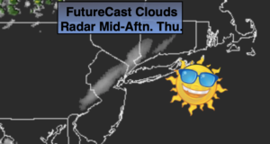
A weak disturbance will ride North from the Baltimore area tonight and for the first half of Friday. Clouds will move in the evening and scattered showers will develop overnight and continue through mid-day Friday. The sun will return Friday afternoon. It’ll be much cooler. The average high is 70º.
The first weekend of October will be bright and chilly as high pressure influences the area from Canada.
Low pressure will develop over the Mid-Atlantic on Monday and move Northeast. Showers are in the forecast.
Stay Tuned.
Keep it here for a no nonsense, no hype forecast..
Today:
Mostly sunny. Highs in the lower 70s. West to Southwest winds at 5-10mph.
Tonight:
Thickening clouds with showers developing. Lows in the mid 50s in the City, the 40s and 50s inland. Northwest winds at 5mph.
Friday:
Scattered showers through mid-day. Increasing afternoon sunshine. Cooler. Highs in the mid 60s.
Saturday:
Mostly sunny. Cool. Highs in the mid 60s.
Sunday:
Mostly sunny. Highs in the mid 60s.
Monday:
Mostly cloudy with scattered showers. Highs in the mid 60s.