Synopsis:
Today will be warm under mostly sunny skies as high pressure works in from the Great Lakes. Readings will be a few degrees above the average high of 76º. The cool push with this system will be felt tonight and Tuesday. An October preview is on the way. The coolest night of the September so far will be with us. Despite the abundant sunshine on Tuesday readings will be hard pressed to reach 70º. The sun will dominate through Thursday as high pressure once again dominates with moderating temperatures.
Another shot of Canadian air will reach the region by Friday and into the beginning of the weekend.
Stay Tuned.
Keep it here for a no nonsense, no hype forecast.
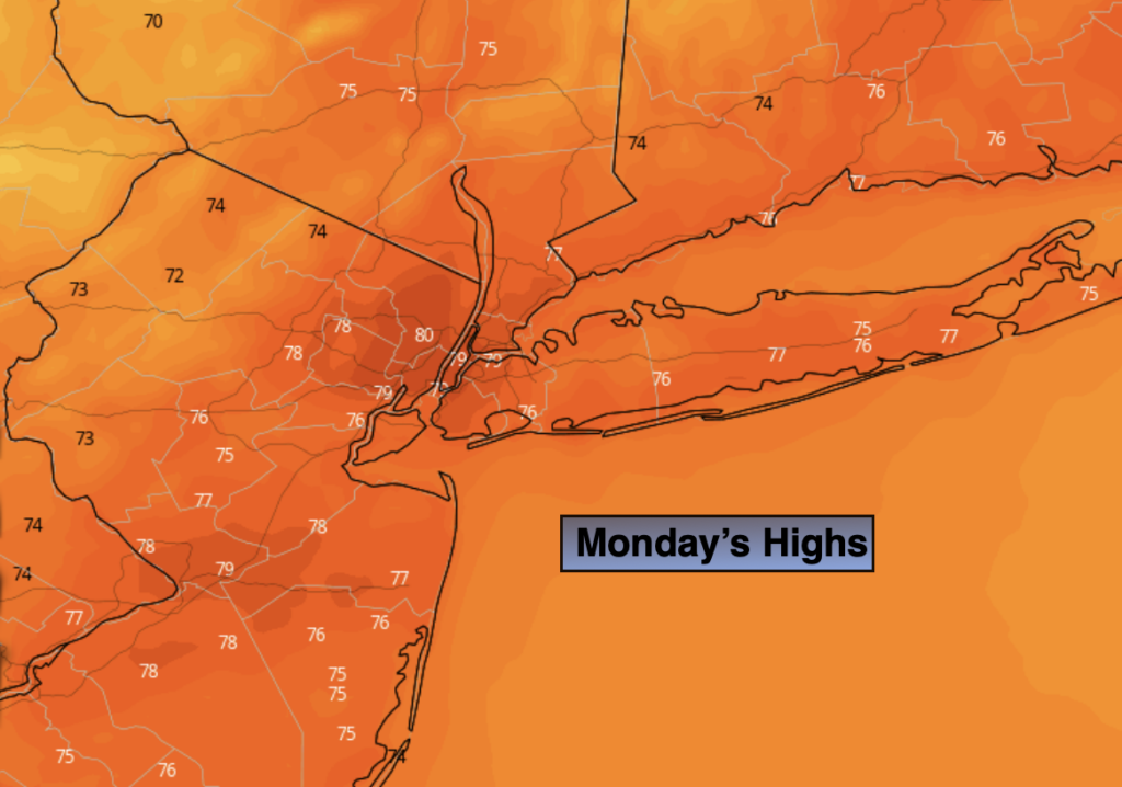
Today:
Mostly sunny and warm. Highs near 80º. Northwest winds at 10-20mph.
Tonight:
Clear and much cooler. Lows in the mid 50s in urban areas, the 40s inland. North wind at 10-15mph.
Tuesday:
Sunny and much cooler. Highs around 70º.
Wednesday:
Mostly sunny. Highs in the mid 70s.
Thursday:
Partly sunny. Highs in the upper 70s.
Friday:
Partly sunny. Cooler. Highs in the lower 70s.