Synopsis:.
A storm will track from the Great Lakes into Eastern Canada through Tuesday. This is a warm storm track for the East coast. Periods of rain are expected today. There will be a break in the rain from late morning into this afternoon. Another round of steadier and heavier rain will work in for the evening commute. The rain will taper off tonight.
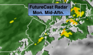
On Tuesday much of the day will be dry until later in the afternoon as a cold front works in. Rain will develop by mid afternoon. It’ll feel more like Spring than early December.
Late Tuesday night and Wednesday the potent cold front will swing through. The latest computer guidance suggests the rain will turn to a period of snow overnight Tuesday into Wednesday morning. If the leftover precipitation is heavy enough there could be some accumulation. At this time there is the potential for a 1″-3″ snowfall (this is in no way etched in stone). The sun will return with much colder readings during the afternoon.
Cold high pressure will work over the region on Thursday. Despite the abundant sunshine readings will only be near freezing.
It won’t be as harsh on Friday under a mix of sun and clouds.
Weather whiplash the next 5 days. Hang on!
Stay Tuned.
Keep it here for a no hype, no nonsense forecast.
Today:
Morning rain will taper off. Another round of rain will work in before the evening commute. Much milder. Highs in the mid 50s. South winds at 8-12mph.
Tonight:
Cloudy. Evening rain will taper off. Very mild. Lows will be in the 50s in the City, this is well above the average high for the date of 45º! Southwest winds at 10-15mph.
Tuesday:
Cloudy. Balmy. A spot shower through early afternoon. Rain will develop later in the day. Highs near 60º.
Wednesday:
The potential for a period of morning snow, otherwise becoming mostly sunny and colder. Highs only in the 30s.
Thursday:
Sunny and cold. Highs only in the upper 20s to around freezing in the City.
Friday:
Sun to afternoon clouds. Highs in the lower 40s.