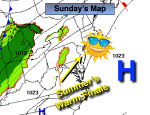
Synopsis:
High pressure off the Eastern seaboard will result in a Southwesterly warm wind. Summer will go out strong with readings ten or more degrees above the average high of 74º today. The beaches will again be packed. The sun will dominate and sunscreen is recommended.
Autumn arrives on Monday (3:50AM EDT) but the conditions will feel anything but fall-like. Temperatures will once again reach well into the 80s!
A cool front will move through Monday night uneventful (a few showers are possible), our search for significant rain continues. Temperatures will not be as toasty on Tuesday. Readings will remain above average through the week as our dry stretch continues.
Stay Tuned.
Keep it here for a no nonsense, no hype forecast.
Today:
Sunny. Warm. Highs in the mid 80s. South to Southwest wind at 8-12mph.
Tonight:
Partly cloudy and muggier. Much warmer than recents nights. Lows near 70º in urban areas, the 60s inland. Southwest wind 5-10mph.
Monday:
Partly sunny, warm and humid. Highs in the mid 80s.
Tuesday:
Partly sunny. Not as warm. Highs in the mid 70s.
Wednesday:
Sunny. Highs in the mid to upper 70s.
Thursday:
Partly sunny, warmer. Highs in the lower 80s.