Synopsis:
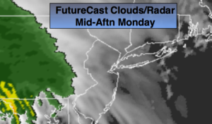
High pressure moving off the coast will result in some morning sun today. A storm developing over the Ohio Valley will cause clouds to thicken rapidly soon after sunrise. Rain will develop by mid-afternoon. Temperatures for the majority of the day will be in the 40s. At the stroke of midnight, it’ll be raining but it will be mild. The actual high for the day will occur as we ring in the new year. At this time readings will be around 50º! A far car from last year’s New Year’s Eve when it was 9º!
January 1st won’t feel like the season, as the warm temperatures will stick around. Temperatures will be near 60º!
Colder air will rush in for midweek as high pressure over the plains supplies air from Canada.
The models continue to show a low developing over the piedmont of the Carolina’s on Friday. The GFS model was thrown out for it’s total lack of consistency. At this time; I’m leaning more toward a rain event for late week. The strong Pacific jet stream continues to dominate and there is no supply of cold air. The time frame looks to be Friday into Saturday morning. Plenty of time to watch things unfold. Nothing is etched in stone.
You know where to find a no hype, no nonsense forecast.
Stay tuned.
New Year’s Eve:
Early sun giving way to clouds. Rain develops during the afternoon. Mild. Highs in the 40s. Southeast winds at 5mph.
Tonight:
Rain, heavy at times through midnight, then scattered showers. Temperatures rising through the 40s inland and into the 50s along the coast. Southeast winds at 8-12mph then becoming Southwest after midnight and increasing to 10-20mph with gusts to 30mph late.
New Year’s Day:
Partly sunny and warm. Highs near 60º.
Wednesday:
Mostly sunny. Colder. Highs around 40º.
Thursday:
Partly sunny. Highs in the lower 40s.
Friday:
Rain likely. A mix possible inland. Highs around 40º.
Keep it here for a no nonsense, no hype forecast.