Synopsis:
Winter arrived at 5:23PM EST Friday. Daylight will begin to get longer, starting today!
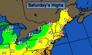
The storm that gave the region between one to almost four inches of rain is moving North into Southern Canada. The intense storm along with high pressure working in from the West will result in a gusty wind. A mix of clouds and sun is expected. We’ll finally get to dry out. Readings will be at least ten degrees above the average high of 40º.
On Sunday the winds will have abated and the sun will dominate. It’ll be cooler.
A ripple of low pressure will rapidly move in on Sunday night with scattered rain and or snow showers. There could be a coating of snow inland by Monday morning, otherwise Christmas Eve day will be mostly sunny. Christmas Day will feature sunshine and seasonal readings. No white Christmas this time around. High pressure will dominate.
Looking down the pike for the Holiday week the next chance of precipitation comes along Thursday night into Friday. Once again it looks too warm for snow-rain is expected at this time.
You know where to find a no hype, no nonsense forecast.
Stay tuned.
Today:
Partly sunny.Windy. Highs around 50º. West to Northwest winds at 15-30mph with higher gusts.
Tonight:
Mostly clear and colder. Winds will diminish. Lows in the lower to mid 30s in the City and along the coast, the 20s inland. West to Northwest winds 10-20mph and diminishing.
Sunday:
Mostly sunny. Highs in the lower 40s.
Christmas Eve:
Chance of early morning snow showers, otherwise mostly sunny. Highs in the lower 40s.
Christmas Day:
Sunny and seasonal. Highs around 40º.
Wednesday:
Mostly sunny. Highs around 40º.
Keep it here for a no nonsense, no hype forecast.