Synopsis:
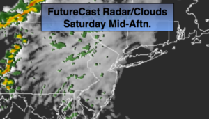
High pressure over Northern New England will result in a wind off the ocean today. Moisture will be trapped at the lowest level of the atmosphere and will cause clouds to dominate today. Patchy drizzle is possible this morning. Most areas will be dry. Readings will be seasonal-in the upper 60s.
The high pressure will move over the region and offshore Sunday. Temperatures will pop once again to well above the average highs as winds begin to turn to a Southerly direction. Clouds will give way to sun on Sunday.
Another high will move toward Northern New England again on Monday. This will once result in a flow off the ocean. Columbus Day will be mainly grey with spotty showers or areas of drizzle possible.
This high looks to park itself over the off the Eastern Seaboard Tuesday and Wednesday resulting in above average temperatures and dry conditions.
You know where to find a no hype, no nonsense forecast.
Stay tuned.
Today:
Mostly cloudy with spotty morning morning drizzle. Highs in the upper 60s. East to South Southeast winds at 5-10mph.
Tonight:
Mostly cloudy with areas of drizzle. Lows in the mid 60s in the City, the upper 50s inland. South to South Southwest winds at 5mph.
Sunday:
Morning clouds will give way to partly sunny skies, much warmer. Highs in the upper 70s.
Monday:
Mostly cloudy with scattered showers or areas of drizzle possible. Highs in the lower to mid 70s.
Tuesday:
Mostly sunny. Warm. Highs near 80º.
Wednesday:
Mostly sunny. Warm. Highs near 80º.
Keep it here for a no nonsense, no hype forecast.