Synopsis:
High pressure will move for today and Thursday with fair conditions and below average temperatures. The average high is 57º.
It’ll turn much colder Friday into Saturday as a significant cold front moves by. A hard freeze is expected throughout the tri-state area Friday night-readings will be in the 20s. The weekend will feature plenty of sunshine with readings recovering into the lower 50s by Sunday.
Stay tuned.
Today:
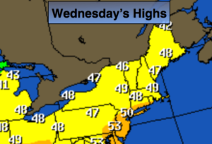
Partly sunny and chilly. Highs around 50º. North to Northeast winds at 8-12mph.
Tonight:
Clear to partly cloudy. Cold. Lows in the lower 40s in the City, the 20s and 30s inland. North to Northeast wind at 8-12mph.
Thursday:
Partly sunny, cool. Highs in the lower 50s.
Friday:
Partly sunny, windy and much colder. Highs only around 40º. Temperatures falling into the 30s by mid-afternoon.
Saturday:
Sunny, breezy and cold. Highs in the lower 40s.
Sunday:
Partly sunny and cool. Highs in the lower 50s.
Keep it here for a no nonsense, no hype forecast.