Synopsis:
The front responsible for our cooler and more comfortable conditions has moved offshore. An upper level disturbance will move into the area tonight causing scattered showers and storms.
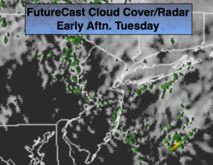
On Tuesday clouds will dominate with a moist flow off the ocean. Spotty showers can’t be ruled out. More sun is likely later in the afternoon. It will be unseasonably cool with readings about ten degrees below average.
Wednesday will be a gem abundant sunshine and low humidity as high pressure moves in.
Warmer and more humid conditions will return by weeks end with a scattered storm threat Thursday night into Friday morning.
Stay tuned.
Tonight:
Scattered showers and thunderstorms. Very cool lows in the lower to mid 60s in the City the upper 50s inland. Northeast winds at 8-12mph.
Tuesday:
Mostly cloudy. Spotty showers. Cool with highs only in the lower to mid 70s. Northeast winds at 8-12mph.
Wednesday:
Sunny and pleasant. Highs in the upper 70s.
Thursday:
Partly sunny. Highs in the lower 80s.
Thursday:
Partly Sunny. Chance of a late day storm. Highs in the lower 80s.
Friday:
Partly sunny with scattered storms during the morning. Highs in the lower 80s.
Saturday:
Partly sunny. Highs in the lower 80s.
Keep it here for a no nonsense, no hype forecast.