Synopsis:
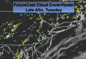
A weak Southerly flow will continue through Wednesday as high pressure remains anchored in the Western Atlantic. This will keep the humidity high. A weak trough will be over the region raising the chances of a spotty storm this afternoon.
Hot times are ahead for late week as a bubble of heat works in from the West and South. The models have been having issues with the timing of a cool front in New England for the Friday through weekend period. Yesterday’s model run had the front pushing through Friday. The latest runs now have the front pushing in some time Saturday. This development will now keep the heat and humidity with us into Saturday.
Stay tuned.
Today:
Partly sunny, warm and humid. Spotty PM Storms. Highs in the mid 80s. South wind at 5-10mph.
Tonight:
Partly cloudy, warm and muggy. Lows in the mid 70s in the City, the mid 60s inland. South to Southwest wind less than 5mph.
Wednesday:
Partly sunny, very warm and humid. Spotty PM Storms. Highs near 90º.
Thursday:
Hazy, hot and humid. Highs 88º-93º.
Friday:
Mostly sunny and hot. Highs in the upper 80s to lower 90s.
Saturday:
Partly sunny, very warm. Spotty PM Storms. Highs in the upper 80s.
Keep it here for a no nonsense, no hype forecast.