Synopsis:
High pressure will begin to build off the Southeast through weeks end. Another winner is expected today. Clouds will give way to partly sunny skies. Temperatures will come up in steps through Friday. By June’s finale (Friday) it’ll be hot once again. Our first chance of a stray storm will come Friday afternoon.
Looking at the long holiday weekend- the weather looks typical for July with warm readings and a chance of afternoon scattered storms from time to time. It will not be a washout. Monday and July 4th looks mainly sunny and warm.
Stay tuned.
Today:
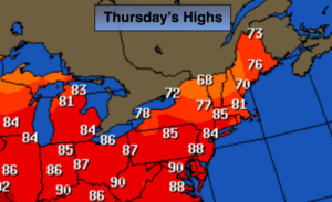
Morning clouds to increasing sunshine. Breezy. Highs in the mid 80s. Southwest winds at 15-25mph.
Tonight:
Partly cloudy, not as cool as recent nights. Lows around 70º in the City, the 60’s inland. Southwest winds at 10-15mph.
Friday:.
Hazy, very warm and humid. A stray afternoon/evening storm is possible. Highs in the upper 80s.
Saturday:
Hazy, very warm and humid. A stray afternoon/evening storm is possible. Highs near 90º.
Sunday:
Hazy, warm and humid. Scattered storms. Highs in the mid to upper 80s.
Monday:
Partly sunny. Warm and humid. Highs in the mid to upper 80s.
July 4th (Tuesday):
Partly sunny. Warm and humid. Highs in the mid 80s.
Keep it here for a no nonsense, no hype forecast.