Synopsis:
Today will start off cloudy but the sun should make an appearance. Along the immediate coast the grey skies may persist. Temperatures will be just above average. The average high for the date is 65º.
A warm front will swing through tonight and Friday morning with scattered showers. Much warmer readings will work in. Temperatures will reach June-like levels. Cooler air will return for Sunday. At this time the weekend looks fairly decent with only a spotty storm expected later Saturday afternoon.
Stay tuned.
Today:
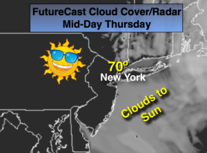
Clouds will give way to some sun, especially inland. It will most likely remain cloudy and the coast. Milder. Highs around 70º. Southeast wind at 5-10mph.
Tonight:
Cloudy with patchy drizzle, scattered showers and areas of fog. Lows in the 50s throughout. Light Northeast wind.
Friday:
Clouds will give way to partly sunny skies. Warm. Highs around 80º.
Saturday:
Summer-like. Partly sunny. Chance of a spotty afternoon or evening thunderstorm. Highs 80º-85º.
Sunday:
Partly sunny. Not as warm. Highs in the mid 60s.
Monday:
Partly sunny. Warmer. Slight chance of a late day storm. Highs in the mid to upper 70s.
Keep it here for a no nonsense, no hype forecast.