Synopsis:
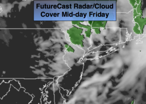
A moderation in temperature will occur today. A warm front will approach with a few spotty showers otherwise a mix of clouds and sun is expected (FutureCast radar/satellite map above). Highs will approach the seasonal averages for the day.
The weekend will feature a 50/50 split with Saturday being the better of the two days. Under a mix of clouds and sun highs will pop into the 50s & 60s on Saturday on a Southwest wind. Spotty showers can’t be ruled out especially North during the afternoon. On Sunday a stationary front will be to our South with on and off showers. The latest computer guidance suggests not a lot of rain will fall. The wind will be off the cold Atlantic keeping readings only in the 40s.
Stay Tuned.
Today:
Mostly cloudy in the morning. Scattered showers are possible until mid-day. Sunshine will increase during the afternoon. Highs near 50º. Southwest wind at 10-15mph.
Tonight:
Partly cloudy, not as cold as recent nights. Lows in the mid 40s in the City, the 30s inland. Southwest wind at 5-10mph.
Saturday:
Mostly cloudy, warmer. Showers are possible during the afternoon, especially North. Highs in the 50s North, the 60s South.
Sunday:
Mostly cloudy with on and off light rain. Much colder. Highs in the 40s.
Monday:
Periods of rain with highs around 50º.
Tuesday:
Mostly cloudy with showers possible. Highs in the 50s.
Stay Tuned.
Keep it here for a no nonsense, no hype forecast.