Synopsis:
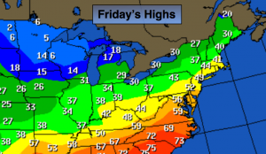
Our January thaw consisted of record breaking temperatures on Thursday. Most areas shattered their record highs as temperatures skyrocketed into the 60s! A cool front has moved through and will bring our readings down twenty degrees from yesterday’s highs (still temps will be well above average).
Colder weather will return this weekend (map above shows colder air moving into the upper plains today. This will head our way). A strong, cold high will be to our North as a stationary front throws moisture to the North. All the models have gone significantly lighter with the precipitation field. At this time flurries or snow showers are possibility later Saturday and Saturday Night. This will not be a big deal.
Looking down the pike the weather pattern will look more like Spring with a ridge of high pressure off the Southeast coast. This is a snowstorm killer. Mild temperatures are expected the next seven to ten days.
Today:
Partly sunny. Not as warm as Thursday, but the thaw continues. Highs in the mid to upper 40s. The average high for this time of the year is 38º.
Tonight:
Partly cloudy, much colder than recent nights. Lows will be in the mid 20s in the City, near 20º inland. Northwest to North wind diminishing to 5-10mph.
Saturday:
Sun will give way to increasing clouds. Colder. Highs in the mid 30s. Chance of flurries or snow showers later in the afternoon and at night.
Sunday:
Mostly sunny and seasonal with readings around 40º.
Monday (MLK Day):
Partly sunny with highs around 40º.
Tuesday:
More clouds than sun with a few showers. Mild. Highs in the upper 40s.
Stay Tuned.
Keep it here for a no nonsense, no hype forecast.