Synopsis:
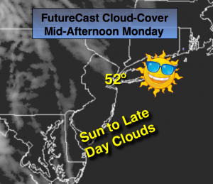
High pressure will slip off the Eastern seaboard today. This will result in mainly sunny skies with high clouds rolling in during the afternoon (FutureCast cloud-cover above). A large low pressure system will continue to intensify in the mid-section of the country and move to the Northern Plains Tuesday and Wednesday. This storm will allow a warm front to move in to the region Tuesday. A one, two shot of rain is expected. The first round of rain will occur on Tuesday. It’ll feel more like Spring with a Southerly wind. A cool front will approach on Wednesday-November’s finale, with the second shot of rain developing during the afternoon. Highs on Wednesday will be in the lower 60s! Skies will finally clear out for December’s debut on Thursday. It won’t feel like December though. Readings will be well into the 50s. The total rainfall has the potential to be significant, this will hopefully help the drought situation. Snow lovers you’re going to have to wait. Looking down the pike it does look to get active and much colder as we head into December-stay tuned.
Monday:
Sunny skies. Highs clouds will work in later in the day. Highs in the lower 50s. Winds becoming South at 5mph.
Tonight:
Thickening clouds. Temperatures will actually rise through the 40s and be around 50º in the City by morning. Southeast wind at 5mph.
Tuesday:
Rain developing during the morning. Warm. Highs around 60º.
Wednesday:
Mostly cloudy with rain redeveloping during the afternoon. Balmy. Highs in the lower 60s.
Thursday:
Becoming partly sunny. Still mild. Highs in the mid to upper 50s.
Friday:
Partly sunny, more seasonal. Highs in the upper 40s.
Stay Tuned.
Keep it here for a no nonsense, no hype forecast.