Synopsis:
After record breaking heat the last couple of days much cooler times are ahead and by the weekend temperatures will plummet into the 50s for highs.
An onshore flow will keep the clouds hanging tough over our region today. There will be times of sun. A shower can’t be ruled out but much of the time will be dry. A cold front and offshore storm will keep the threat of spotty showers on Friday. As the storm and front get their act together just offshore on Saturday morning a period of showers is possible. Much colder air will filter in behind these systems Saturday on a strong Northwest wind. Sunday will be fair and chilly with gusty winds.
Today:
More clouds than sun. A stray shower is possible, much cooler with highs in the upper 60s to mid 70s. Northeast to East wind at 10-15mph.
Tonight:
Mostly cloudy with areas of drizzle. Lows in the lower 60s in the City, the mid 50s inland. Southeast wind at 5mph.
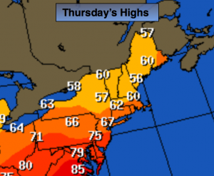
Friday:
Mostly cloudy with scattered showers. Highs around 70º.
Saturday:
Morning showers will give way to partly cloudy skies. Windy and much cooler. Highs will be in the mid to upper 50s. Winds will gusts up to 40mph making it feel like the 40s.
Sunday:
Partly sunny, breezy and unseasonably cool. Highs in the upper 50s.
Monday:
Partly sunny and seasonal. Highs in the lower 60s.
Stay Tuned.
Keep it here for a no nonsense, no hype forecast.