Synopsis:
Strong high pressure will dominate our weather through today. Another Fall Classic will be experienced. Picture perfect pumpkin pickin’ weather continues.
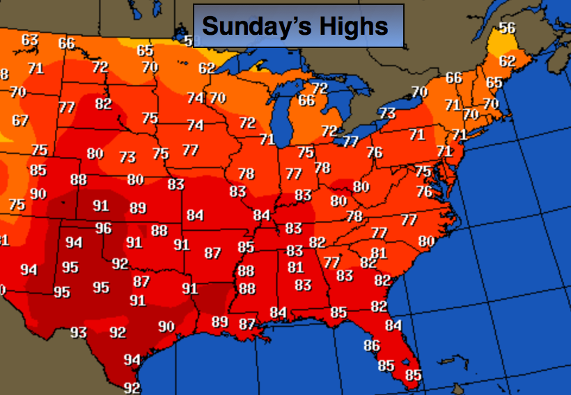
As the high pressure system moves off the coast the return Southwesterly flow will bring up very warm air for this time of the year this week. A bubble of 80’s is located in the mid-section of the country. These warm readings are headed toward our area Temperatures maybe fifteen degrees or more above normal by Tuesday and Wednesday- reaching 80º or above. These readings are more typical for mid to late June!
Today:
Mostly sunny and warmer. Highs around 70º. Southwest wind at 5-10mph.
Tonight:
Becoming mostly cloudy, a spotty shower can’t be ruled out. Much milder than recent nights. Lows in the lower 60s in the City, the mid 50s inland. Southwest wind at 5mph.
Monday:
More clouds than sun, warmer. A stray shower is possible. Highs in the mid 70s.
Tuesday:
Mostly sunny and much warmer. Highs in the lower 80s.
Wednesday:
Mostly sunny and balmy. Highs in the lower 80s.
Thursday:
Partly sunny, still warm. Highs in the mid 70s.
Stay Tuned.
Keep it here for a no nonsense, no hype forecast.