Synopsis:
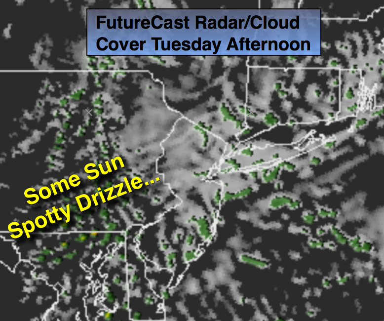
An area of high pressure will move in from Eastern Canada today. With the onshore flow there maybe some low level moisture that could lead to areas of drizzle in the morning, but some sunshine is expected. It looks as though the atmosphere will dry out as the high dominates mid to late week with partly sunny to mostly sunny skies.
Hurricane Matthew is a category 4 storm with winds of 145mph. The storm continues to move just East of North. It will make landfall this morning in Western Haiti and then continue to the Eastern tip of Cuba later in the day. Severe flooding and damage with mudslides is expected over Haiti. The Bahamas will feel the wrath of Matthew mid to late week-a prolonged and very likely a damaging scenario is setting up for the island chain (map below). Will the storm strike the East coast? The potential has increased over the Carolina’s. The latest track has the storm closer to the coast due to the fact that high pressure continues to build in the Western Atlantic and will keep the hurricane from going out to sea. Once it get to the latitude of the Outer Banks will it turn out to see or will in continue up the coast? Thats the million dollar question. I’m going with a 70/30 chance of the storm coming close enough for us to feel it’s affects. As we know with all hurricanes; they have a mind of their own. The hurricane won’t be a anywhere near our latitude until Saturday. Many days to watch the details unfold. Stay tuned.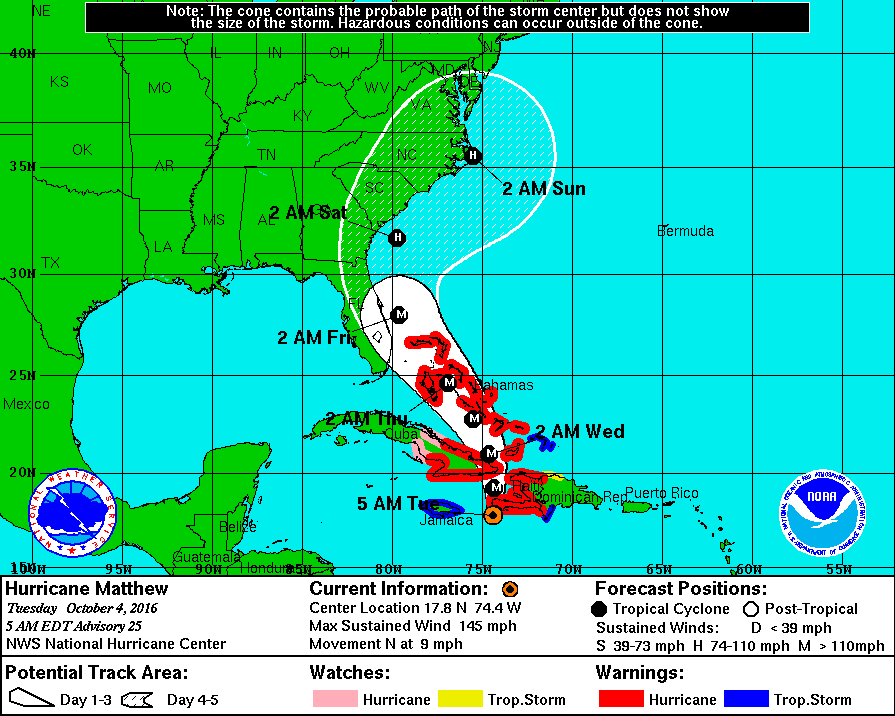
Today:
Mainly cloudy this morning with spotty showers or areas of drizzle. Afternoon Sun is possible. Seasonal. Highs in the upper 60s. Northeast winds at 10-15mph.
Tonight:
Partly cloudy. Lows in the mid 50s in the City, the mid 40s inalnd. Northeast wind at 5-10mph.
Wednesday:
Sunny. Highs in the upper 60s.
Thursday:
Sunny. Highs around 70º.
Friday:
Mostly Sunny. Highs around 70º.
Saturday:
Partly Sunny. Highs around 70º.
Stay Tuned.
Keep it here for a no nonsense, no hype forecast.