Synopsis:
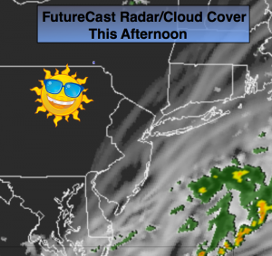
A weak front has slipped of the coast. Any coastal rain this morning will end and skies will become mostly sunny as the day goes on (FutureCast radar/cloud cover above shows clouds parting for sunshine). Temperatures will be above average.
High pressure will ridge down the New England coast on Wednesday. The day will start will some sunshine but clouds will once again roll in. Drizzle is possible later in the day with the onshore flow.
An area of low pressure will drop out of the Great Lakes and move to the Mid-Atantic and stall for a couple of days. On and off rain is likely Thursday into Friday. We’ll take all the rain we can get.
Today:
Clouds and morning coastal showers will give way to partly sunny skies. Highs in the mid 70s. Northwest to Southwest wind at 5-10mph.
Tonight:
Mostly clear and cool with lows in the lower 60s in the City, the mid 40s inland. Winds becoming North at 5mph.
Wednesday:
Sun will give way to clouds. Late day drizzle is possible. Highs in the lower 70s.
Thursday:
Mostly cloudy with periods of rain. Highs in the upper 60s.
Friday:
Mostly cloudy with periods of rain. Highs in the upper 60s.
Saturday:
Mostly cloudy with spotty showers possible. The majority of the day will be dry. Highs near 70º.
Stay Tuned.
Keep it here for a no nonsense, no hype forecast.