Synopsis:
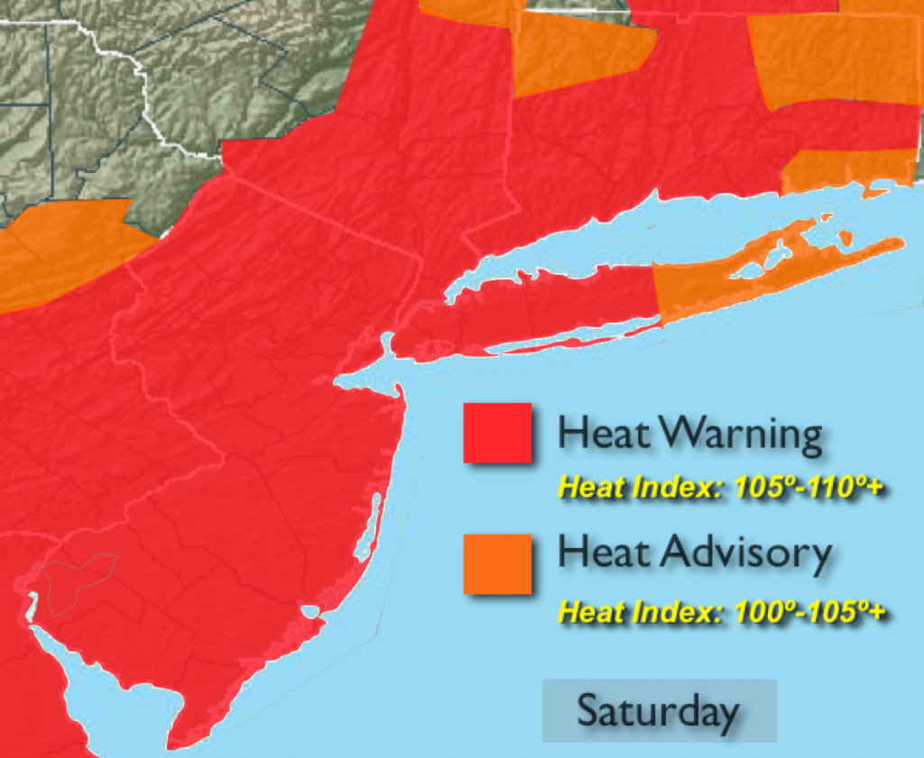
A strong Bermuda high pressure system will continue to pump up oppressive heat and humidity through the weekend. The heat wave will be taxing to the body. Hydrating will be of upmost importance. Temperatures will climb into the 90s and the very high humidity will translate into a heat index of 100-110º+ through the weekend. The heat will peak today. The threat of afternoon storms will be spotty in nature. Much of the time will be dry. Overnight lows in the City and urban areas will remain in the lower 80s. Yes, August’s unpleasant side will be with us for some time.
The heat wave is expected to break on Tuesday.
Today:
A sizzling Saturday. Hazy and oppressively humid with spotty PM storms. Highs in the mid to upper 90s. Heat index of 100º-110+º. Southwest wind at 10-20mph.
Tonight:
Partly cloudy with an isolated storm. Muggy and very warm. Lows in the lower 80s in the City and urban corridor, the 70s elsewhere. Southwest wind at 5mph.
Sunday:
Hazy, hot and humid with spotty PM Storms. Highs in the mid 90s. Heat index of 100º-107º.
Monday:
Hazy, hot and humid. Highs in the lower 90s.
Tuesday:
The heat wave should end with temperatures remaining in the upper 80s with scattered showers and storms.
Wednesday:
Sun and clouds with scattered showers and storms. Highs in the upper 80s.
Stay Tuned.
Keep it here for a no nonsense, no hype forecast.